Quarticle & Altitude Partner on Climate Risk
- Category
- News
- Published
- February 18, 2026Last edited July 29, 2026
- Reading Time
- 7 min read
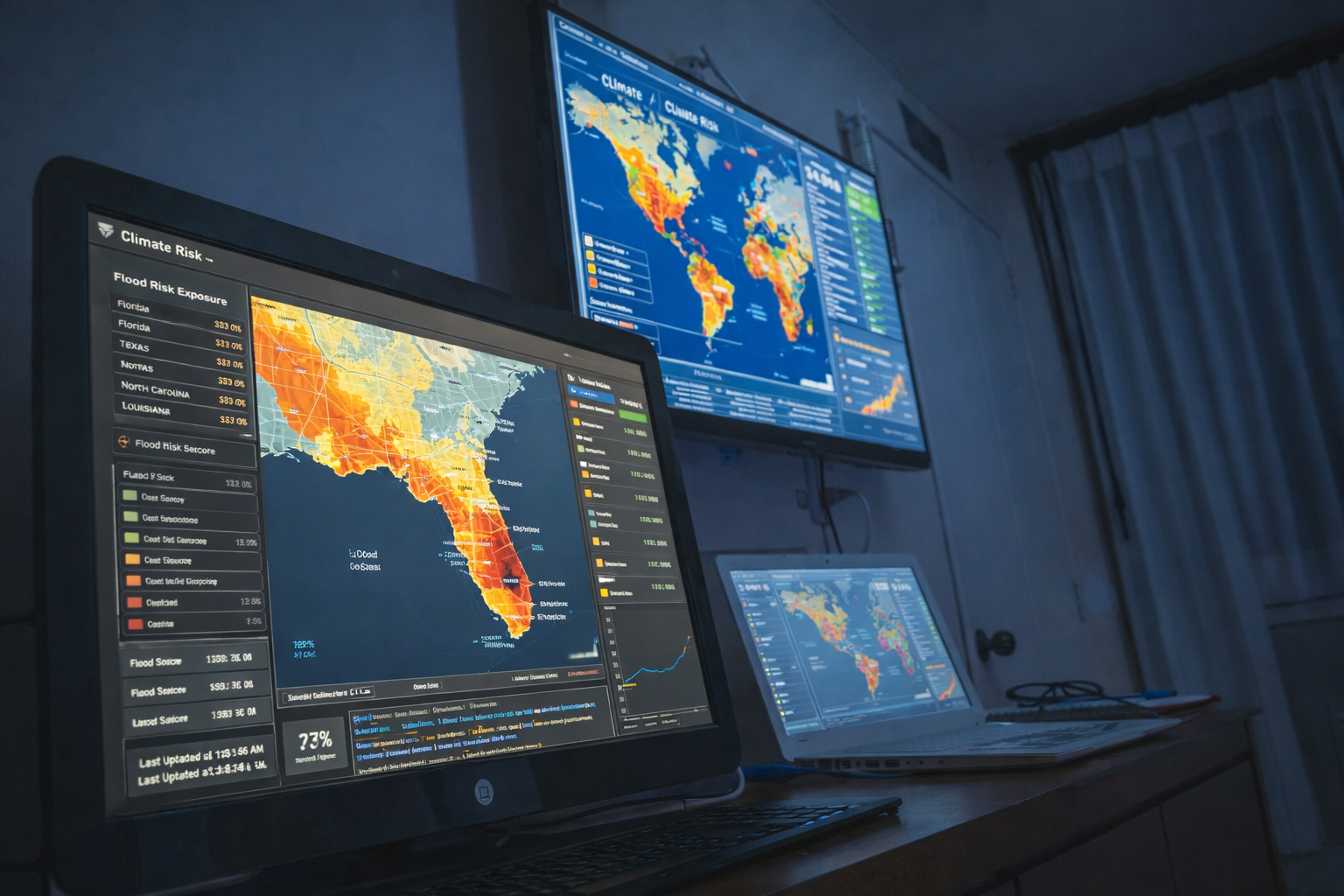
Quarticle and Altitude Intelligence integrate geospatial and climate analytics to deliver decision-ready risk insights for insurers and risk managers.
Altitude Intelligence Team

In a world where climate volatility, regulatory pressure, and systemic risk are becoming increasingly complex, organizations can no longer rely on fragmented data to guide critical decisions. In this context, the partnership between Quarticle and Altitude Intelligence is both timely and strategically important. It reflects a broader shift toward integrated, location-aware risk intelligence.
By combining Quarticle’s advanced geospatial capabilities with Altitude Intelligence’s climate and risk analytics expertise, the collaboration brings deeper spatial context into underwriting and strategic workflows. Importantly, the objective is not simply integration. Rather, it is transformation. Risk data becomes clearer, more defensible, and directly usable in decision-making environments.
The Growing Complexity of Climate and Risk Data
Over the past decade, risk assessment has evolved rapidly. Climate models have become more granular, hazard datasets more detailed, and regulatory requirements more demanding. At the same time, insurers and risk managers face increasing expectations to quantify exposure under multiple climate scenarios and to demonstrate defensible underwriting practices.
However, despite this expansion in available data, clarity has not always followed. In practice, many organizations still operate with siloed systems, disconnected models, and static reporting tools. As a result, risk intelligence can remain fragmented, limiting its practical value.
The challenge, therefore, is no longer access to data. It is integration and usability. This is precisely where spatial intelligence becomes essential.

Why Geospatial Context Changes Risk Intelligence
Risk is fundamentally shaped by geography. Climate exposure, infrastructure vulnerability, and portfolio concentration are not abstract variables. They are location-specific realities. Without spatial context, risk analysis remains incomplete and decision-making remains partially informed.
- Risk becomes measurable geographically, not just statistically, allowing decision-makers to see concentration, proximity, and clustering in real terms.
- Portfolio exposure can be evaluated at precise asset and location levels rather than relying solely on category-based scoring models.
- Predictive climate modeling gains operational relevance when embedded within spatial infrastructure, improving forward-looking scenario analysis.
- Underwriting and portfolio decisions become more defensible through location-aware, data-backed intelligence grounded in real-world exposure.
Embedding Risk Intelligence Into Operational Workflows
Importantly, this partnership does not position geospatial analytics as an external reporting layer. Instead, it embeds advanced climate modeling directly into underwriting and portfolio management systems. As a result, intelligence becomes part of daily operations rather than a periodic review.
This integration enables continuous monitoring and forward-looking scenario modeling. Rather than relying on static reports, organizations can evaluate exposure in real time and assess projected impacts under different climate pathways. Over time, this shift supports stronger resilience planning and more informed capital allocation.
Ultimately, proactive risk management becomes achievable. Decision-makers gain the ability to anticipate concentrations of risk and respond before losses materialize.
Regulatory and Market Drivers
At the same time, regulatory and market pressures continue to intensify. Financial authorities are introducing climate disclosure frameworks and stress-testing requirements. Institutions are increasingly expected to demonstrate how climate risks are identified, measured, and managed.
Meanwhile, investors and reinsurers demand greater transparency and defensibility. Risk management must therefore be both explainable and auditable. In this environment, integrated systems that combine predictive modeling with spatial context become not just advantageous, but necessary.
By embedding geospatial and climate analytics into operational workflows, organizations are better positioned to meet these evolving expectations.
From Insight to Strategic Advantage
It is worth emphasizing that visualization alone is not the end goal. While dashboards improve clarity, the real value lies in decision enablement. When intelligence is embedded into underwriting criteria and portfolio strategy, it directly shapes outcomes.
With integrated analytics, organizations can compare risk-adjusted growth scenarios, rebalance portfolios proactively, and identify vulnerabilities before they escalate. Over time, this capability strengthens not only regulatory alignment, but competitive positioning.
In short, as environmental uncertainty intensifies, the ability to make data-backed, location-aware decisions will increasingly define industry leaders.
A More Integrated Future for Risk Management
Looking ahead, collaboration between geospatial technology providers and climate analytics specialists will likely become standard practice. The complexity of emerging risks requires systems that are interconnected, adaptive, and continuously updated.
The partnership between Quarticle and Altitude Intelligence represents progress toward that future. By aligning spatial infrastructure with predictive modeling, the collaboration supports more transparent, defensible, and forward-looking decision-making.
Ultimately, risk data should do more than inform. It should strengthen strategy, improve resilience, and support confident action in an uncertain world.
Still relying on fragmented risk data?
It may already be costing you visibility, resilience, and defensibility.
Discover how integrated geospatial and climate intelligence changes that.