Jasper Wildfire Analysis
Government Agency
Comprehensive analysis of the Jasper wildfire using satellite imagery and OSINT techniques.

Jasper Wildfire Analysis
About this project
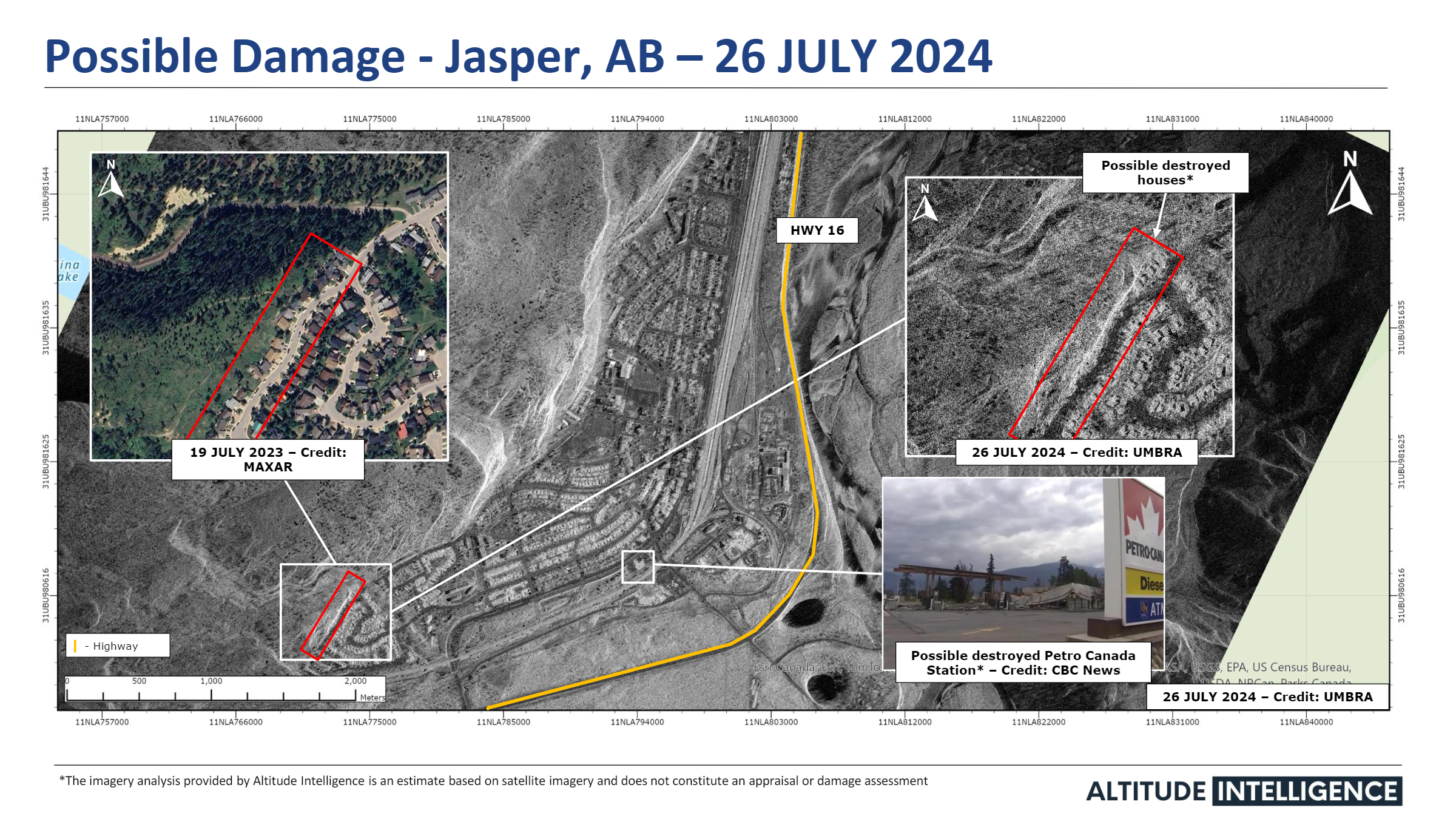
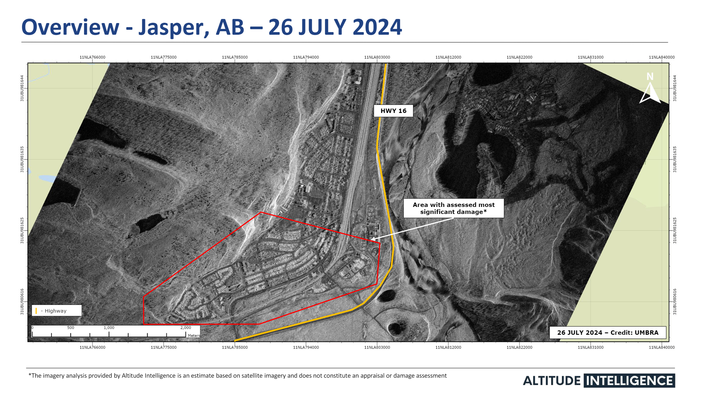
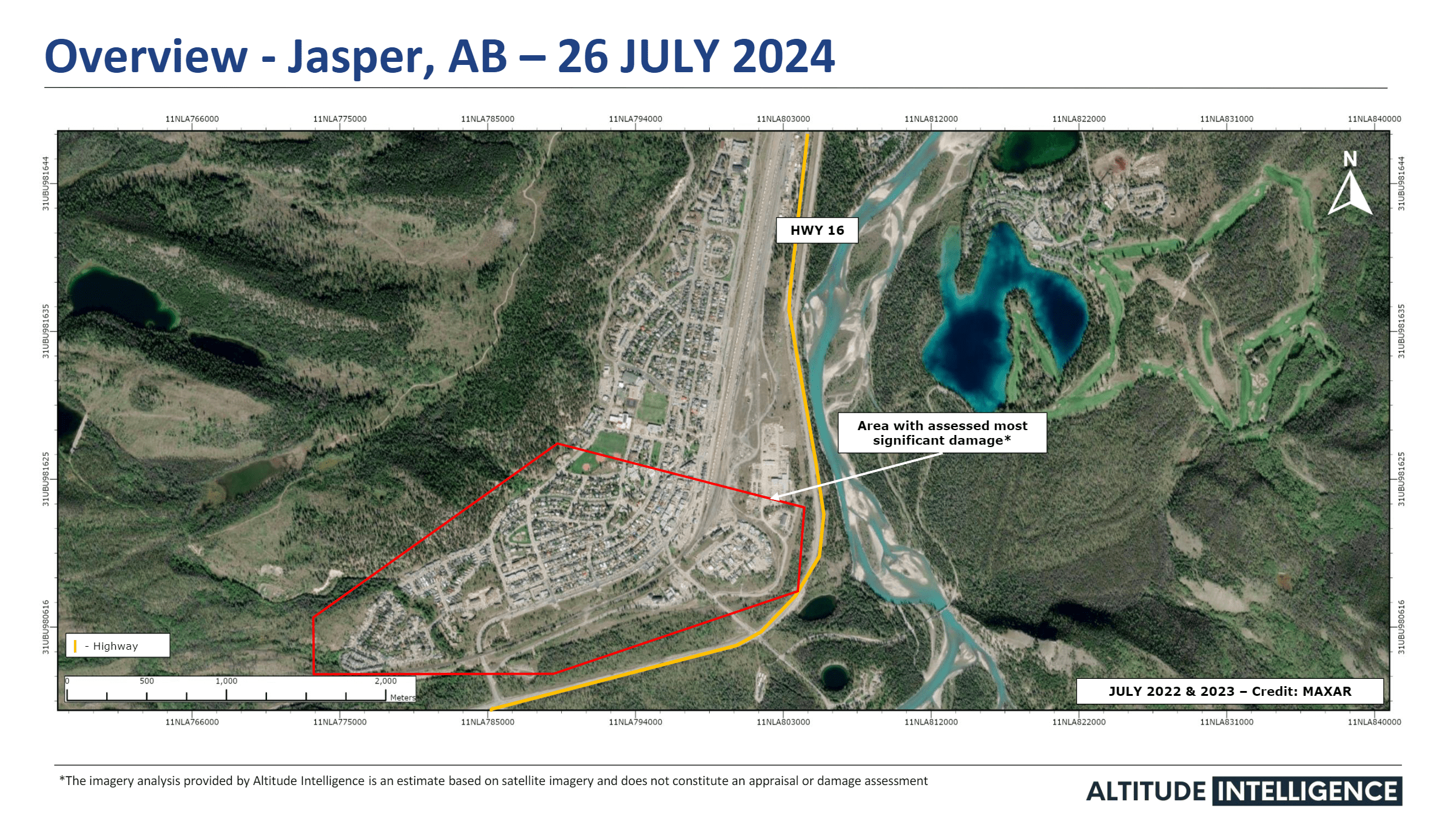
The 2024 Jasper wildfire became one of Canada’s most devastating natural disasters, burning 39,000 hectares, destroying 358 structures, and forcing 25,000+ evacuations. With rapidly changing fire behaviour, emergency agencies relied heavily on timely geospatial intelligence (GeoINT) for situational awareness, damage assessment, and operational planning.
The challenge
Multiple lightning-ignited fires (north & south of Jasper) expanded rapidly under extreme wind and dry conditions.
- Fire progression shifted hourly; smoke and visibility limited aerial assessments.
- Infrastructure risk (hospital, water systems, rail line, highways) required continuous monitoring.
- Public agencies needed near-real-time detection, burn-scar mapping, and structural impact analysis.
Our contribution
Delivered several reports for damage assessment
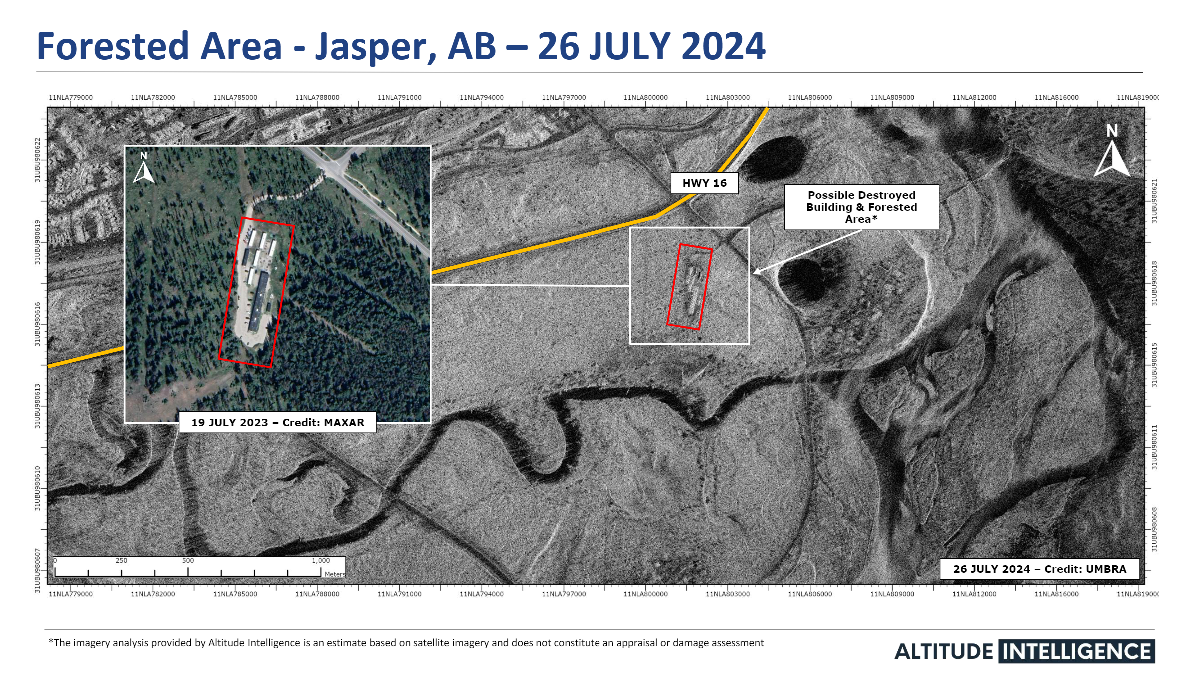
Forested area damage assessment
Possible damage on properties, housing and infrastructure like the petrol station